


Tom McArthur & Doug Faulknerand
Chris Fawkes,Lead weather presenter
 PA Media
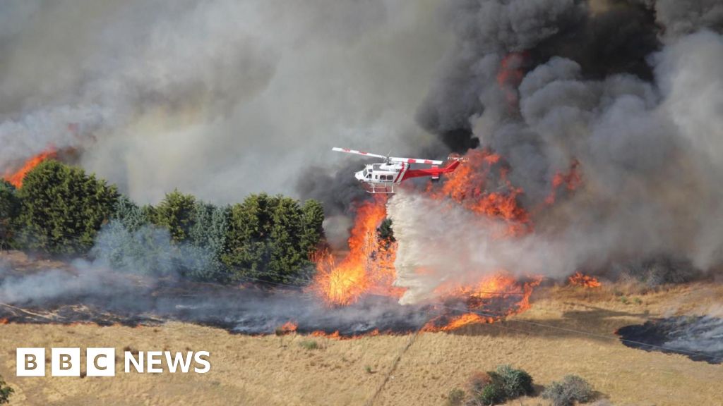
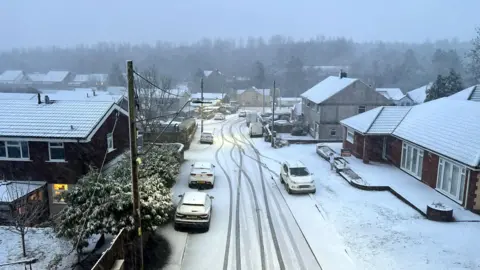
Storm Goretti has brought 99mph (159km/h) winds and heavy snow to the UK, with tens of thousands of people left without power.
A rare red weather warning issued by the Met Office for Cornwall and the Isles of Scilly has come to an end, but an amber warning for snow remains for much of the West Midlands, Wales, Gloucestershire and parts of Yorkshire.
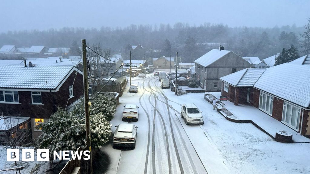
Officials in the Midlands are preparing for the “worst snow in a decade” as 30cm (11in) is expected to fall and disruption to travel is expected into the morning.
More than 65,000 properties in south-west England are without power, according to the National Grid’s website, with a 11,000 in the West Midlands and 2,600 in Wales also without power.
Commuters were urged to complete their journeys before the storm hit. Widespread disruption is expected on the roads and rail network into Friday.
The red wind warning for Cornwall started at 16:00 GMT and ended at 23:00. The Met Office says the “exceptionally strong winds” were likely to cause damage to buildings and homes.
These damaging winds were set to spread to parts of Cornwall, the Channel Islands and north France on Thursday evening.
Gusts of 99mph were reached at St Mary’s Airport on the Isles of Scilly, the Met Office said.
Two emergency alerts were sent out to the mobile phones of about 500,000 people in Cornwall and Isles of Scilly to warn them about the dangerous conditions.
The far south-west of Wales and other parts of southern England were also set to see strong winds, with gusts of 50-60mph, but were not included in the red warning.
The Channel Islands were expected to experience “even stronger winds”. A major incident has been declared in Jersey, where its weather agency also issued a red warning.
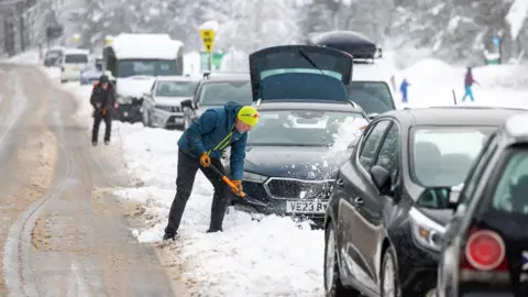
Rain has started to turn to snow over high ground in Wales with snow falling around Libanus, 272m (890ft) above sea level. It is going to be quite a slow process, but over the next few hours more areas of Wales, the Midlands and Peak District will see some disruptive snow with snow ploughs and gritters struggling to keep up snow rates of 4cm per hour – transport disruption is likely.
In the Midlands later in the night the snow may well turn back to rain with conditions slowly easing. In Wales and the Peak District, the snow will hang around longest with 20-30cm likely in places. This will make some roads impassable and will cut off some communities with transport badly affected. There could be some power cuts too.
There are also yellow warnings for rain, wind, snow and ice covering parts of Scotland, Wales and England.
Storm Goretti, named by French forecasters, is currently developing rapidly in the Atlantic with a huge cloud shield now covering much of Northern Ireland, England and Wales.
The storm is likely to undergo “explosive cyclogenesis” or “weather bomb” – a term used where central pressure drops by one millibar (mb) an hour over a 24-hour period, generally resulting in particularly powerful gusts of wind over a period of a few hours.
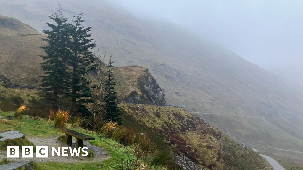
In Wales there is an avalanche warning for Yr Wyddfa, also known as Snowdon, while in the West Midlands local authorities said they were preparing for potentially the worst snowfall in a decade.
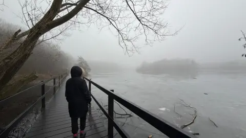
Heavy rain could also bring some localised flooding to parts of south-west Wales and eastern England.
Snow and rain will begin to ease on Friday morning, but with snow on the ground, there is likely to be some travel disruption for the morning commute.
Rail passengers have been advised to check their journeys ahead of travelling on Thursday and Friday as a number of National Rail services are likely to be suspended or disrupted.
In the south-west, all trains were suspended after 18:00 in Cornwall, with no replacement services, while some services in Devon were also cancelled.
East Midlands Railway is not running between Manchester Piccadilly and Sheffield on Thursday evening and all day Friday. No replacement buses will be running.
Experts have urged drivers to heed the warnings for snow and ice and to avoid driving on Thursday evening and into Friday, with the AA saying wintry conditions could “reduce visibility in seconds”.
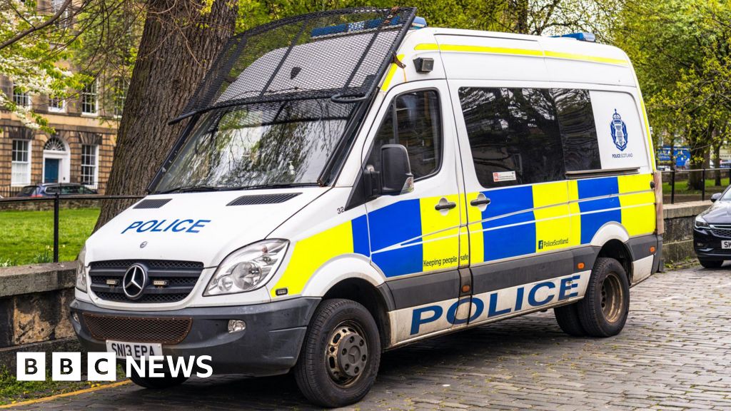
One man told the BBC he was driving “very carefully” with his wife, on the A887 to Edinburgh, when a tree suddenly fell on their car.
“It was quite unbelievable,” said Gerard Cairney, adding that the tree “bounced” off his bonnet. He was able to swerve, avoiding any serious damage, bar some minor scratches on the paintwork.
Meanwhile, Birmingham Airport has suspended its use of the runway due to heavy snow. It advised passengers to contact their airlines about the status of their flights.

 Weather Watchers/Raj’s Range
Meanwhile, some schools are expected to be closed on Friday, with dozens in the Midlands and Wales announcing they will not open in the amber weather warning area.
Almost 100 schools in Cornwall closed early on Thursday ahead of the arrival of the storm.
More than 250 schools are due to remain closed in Scotland on Friday, meaning many pupils are yet to return from the festive break.
In Norfolk, the owners of 14 clifftop homes have been told not to stay in their homes on Thursday because of the risk of cliff falls during the stormy weather. They have been warned their homes are at risk of imminent collapse and must be demolished.
Where are the weather warnings?
A red warning – the most severe – for wind is in place in Cornwall and the Isles of Scilly until 23:00 on Thursday.
Amber warnings for heavy snow are in place in the following areas until 09:00 on Friday:
- The Midlands
- Wales
- South West England
- Yorkshire & Humber
Yellow weather warnings for snow, ice and rain are also in place for the following areas:
- Shetland Islands (snow) 16:00 to 20:00 Thursday
- The Midlands, Yorkshire, Wales, North West and South West England, North East England, East of England, South East England (snow) – until noon on Friday
- Lincolnshire and parts of East of England including Cambridgeshire, Norfolk, Peterborough and Suffolk (rain) – until 21:00 on Friday
- South East England, Wales and South West England (wind) – until 06:00 on Friday
- Northern Ireland (ice) 00:00 to 11:00 Friday
 PA Media
Over the past week, an Arctic blast has brought temperatures of between 4 and 10C below the January average.
The UK Health Security Agency (UKHSA) has issued amber cold health alerts for England which will run until Monday.
Low temperatures have already triggered the government’s cold weather payments across at least 697 postcodes in England, Wales and Northern Ireland. It means that more than one million households will receive money.


